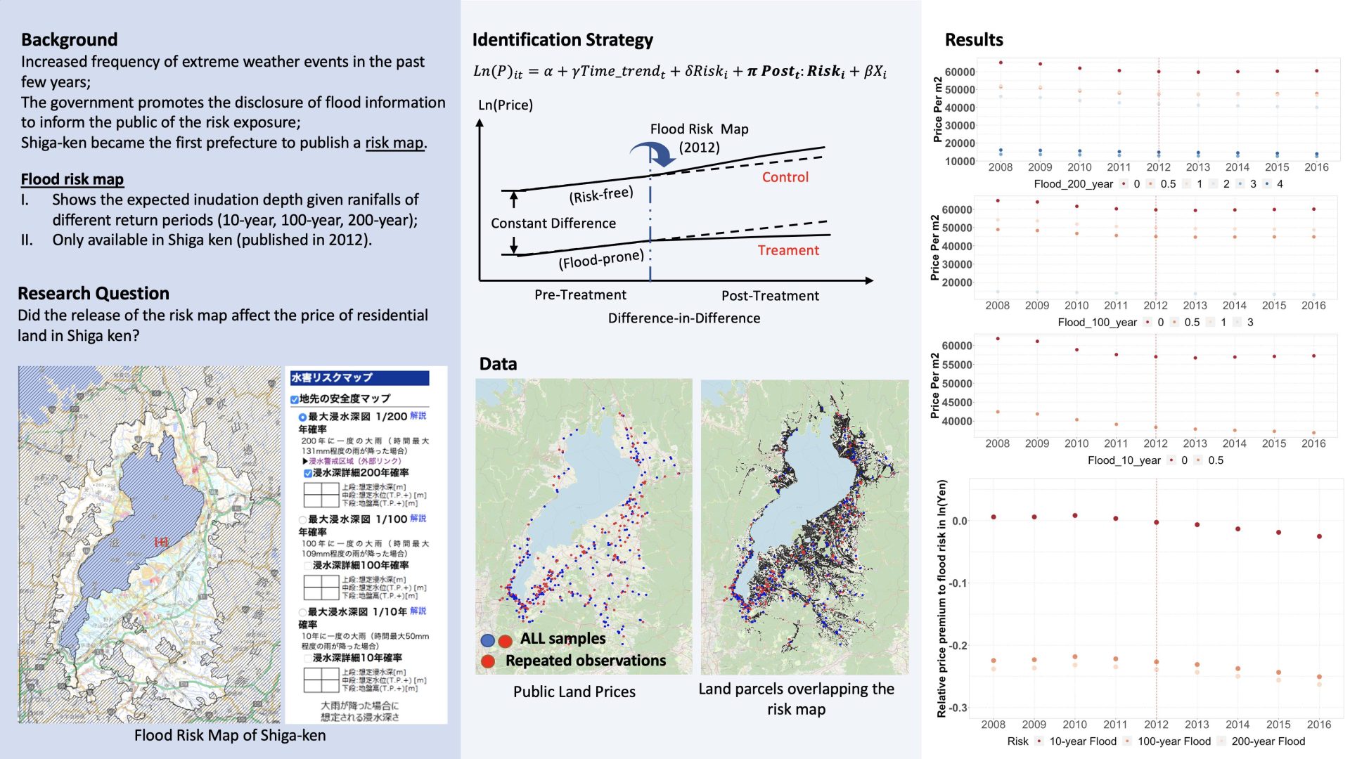
Extreme flood events see an increased frequency due to climate change. Shiga became the first prefecture to publish a flood risk map to inform residents of flood exposure under different risk scenarios. Unlike traditional flood maps on which the inundation depth is estimated using the maximum rainfall, the risk map displays the anticipated inundation based on precipitation of different return periods, providing more detailed information on local risk exposure. This study intends to investigate whether the risk map affected the residential land market in Shiga. Using GIS, we overlap the reference points of parcels, the price of which are evaluated semi-annually by the government, with the risk map to determine the risk exposure. Since land value is predominately determined by geospatial features, We perform spatial difference-in-difference to control for spatial correlation and remove the shocks to the land market due to the unobserved factors. This study will be one of the first that evaluate the response of land markets to Shiga's risk map and contribute to the design of disaster-planning policies.
Urban Planning and Management
Disaster Management
Land Valuation
Spatial Data Analysis
| 氏名 | 専攻 | 研究室 | 役職/学年 |
|---|---|---|---|
| 趙 瀟怡 | 社会情報学専攻 | 防災社会システム研究分野 | 博士2回生 |
| 多々納裕一 | 社会情報学専攻 | 防災社会システム研究分野 | 教授 |